![](/images/other/stat-length.png)
![Trail Walking Le Fau - Crêtes entre Salers et Mandailles : du Puy Chavaroche au Puy Violent. - Photo](https://media.geolcdn.com/t/1900/400/ext.pjpeg?maxdim=2&url=https%3A%2F%2Fservices.sitytrail.com%2FGeolivesWS%2FDownloadMedia.ashx%3FTrailID%3D107448%26Media%3D12372_3.jpg)
Crêtes entre Salers et Mandailles : du Puy Chavaroche au Puy Violent.
tracegps
User
![Length](/images/other/stat-length.png)
![Max alt](https://static1.geolcdn.com/siteimages/upload/files/1508320355ic_sort_altitude_max_24dp.png)
![Uphill gradient](https://static1.geolcdn.com/siteimages/upload/files/1508320355ic_sort_den_pos_24dp.png)
![Km-Effort](/images/other/stat-length.png)
![Min alt](https://static1.geolcdn.com/siteimages/upload/files/1508320355ic_sort_altitude_min_24dp.png)
![Downhill gradient](https://static1.geolcdn.com/siteimages/upload/files/1508320355ic_sort_den_neg_24dp.png)
![Boucle](https://static1.geolcdn.com/siteimages/upload/files/16400158638029165_repeat_loop_refresh_sync_direction_icon.png)
![Walking](https://static1.geolcdn.com/sitytour/trail-icons/101.png)
7h00
Difficulty : Difficult
![Scan this QR Code to open this trail in the SityTrail application](https://capi.geolives.com/qq0zvz2zws4bq2lad0pu/sitytour/trails/107448/qr.png?size=200)
FREE GPS app for hiking
About
Trail Walking of 21 km to be discovered at Auvergne-Rhône-Alpes, Cantal, Le Fau. This trail is proposed by tracegps.
Description
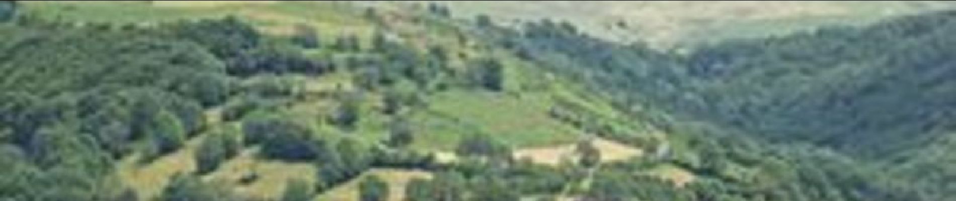
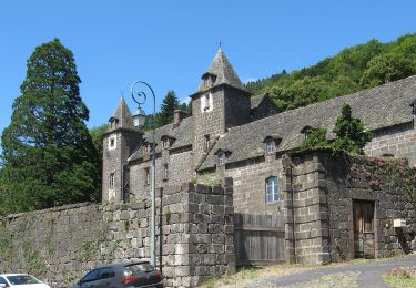
Superbe randonnée qui relie le Puy de Chavaroche au Puy Violent par un sentier de crêtes avec de nombreux points de vue sur les monts du Cantal (Puy Mary, Peyre-Arse, Puy Griou, ...). Sur la portion entre la Roche Taillade et le Puy violent, très peu fréquentée, nous avons pu observer quelques isards (ou chamois si vous préférez). Le départ de la randonnée s'effectue à l'est de Fontanges dans le hameau de La Bastide. On emprunte d'abord le balisage bleu d'un sentier de petite randonnée qui monte vers le sud, qui nous amène sur une piste que l'on suit vers l'est. Cette piste s'achève un peu avant les ruines du Buron de Chavaroche. On continue ensuite à monter vers l'est-nord-est pour trouver une sente qui rejoint le GR 400 sur la crête entre Mandailles et La Bastide. De là, le Puy Chavaroche est tout proche, puis on redescend la crête jusqu'au col de Redondet. Le GR 400 contourne ensuite la Roche Taillade par le sud en traversant la crête entre la Roche Taillade et le Puy d'Orset, puis par l'ouest, avant de revenir sur la crête principale. Après quelques mètres, on laisse le GR 400 sur la gauche qui redescend dans la vallée, et on remonte une sente (par endroit balisée avec des flèches blanches). Un léger écart nous amène au Roc des Ombres. On reprend ensuite la sente qui traverse la crête pour contourner un gendarme, puis remonte légèrement pour traverser à nouveau la crête à la Brèche d'Enfloquet. On se dirige alors plein ouest en suivant la crête qui nous amènera au Puy Violent. Pour la descente à La Bastide, il suffit de suivre le GR 400.
Positioning
Comments
Trails nearby
![Trail Walking Mandailles-Saint-Julien - L'Elancèze - Photo](https://media.geolcdn.com/t/375/260/ext.jpg?maxdim=2&url=https%3A%2F%2Fservices.sitytrail.com%2FGeolivesWS%2FDownloadMedia.ashx%3FTrailID%3D103726%26Media%3D6387_2.jpg)
![Walking Walking](https://static1.geolcdn.com/sitytour/trail-icons/101.png)
Walking
![](/images/other/stat-length.png)
![](https://static1.geolcdn.com/siteimages/upload/files/16400158638029165_repeat_loop_refresh_sync_direction_icon.png)
![Trail Walking Saint-Projet-de-Salers - Col de Légal puy de Chavaroche - Photo](https://media.geolcdn.com/t/375/260/f9dc9d20-5b8f-465f-9704-8a80b10f246f.jpg&format=jpg&maxdim=2)
![Walking Walking](https://static1.geolcdn.com/sitytour/trail-icons/101.png)
Walking
![](/images/other/stat-length.png)
![](https://static1.geolcdn.com/siteimages/upload/files/16400158638029165_repeat_loop_refresh_sync_direction_icon.png)
![Trail Hybrid bike Mandailles-Saint-Julien - Tournemire - Photo](https://media.geolcdn.com/t/375/260/e14f03b2-11fc-4b1e-a416-809203cb4d66.jpg&format=jpg&maxdim=2)
![Hybrid bike Hybrid bike](https://static1.geolcdn.com/sitytour/trail-icons/203.png)
Hybrid bike
![](/images/other/stat-length.png)
![](https://static1.geolcdn.com/siteimages/upload/files/16400158638029165_repeat_loop_refresh_sync_direction_icon.png)
![Trail On foot Le Falgoux - Sentier de la cascade du Biaguin - Photo](https://media.geolcdn.com/t/375/260/9b956c23-a7e6-4fa5-9a0a-8ae63187caec.jpeg&format=jpg&maxdim=2)
![On foot On foot](https://static1.geolcdn.com/sitytour/trail-icons/100.png)
On foot
![](/images/other/stat-length.png)
![](https://static1.geolcdn.com/siteimages/upload/files/16400158638029165_repeat_loop_refresh_sync_direction_icon.png)
![Trail On foot Le Falgoux - La Baladie - Photo](https://media.geolcdn.com/t/375/260/9844acfe-57cd-4ed2-9915-09bb258bc9c1.jpeg&format=jpg&maxdim=2)
![On foot On foot](https://static1.geolcdn.com/sitytour/trail-icons/100.png)
On foot
![](/images/other/stat-length.png)
![](https://static1.geolcdn.com/siteimages/upload/files/16400158638029165_repeat_loop_refresh_sync_direction_icon.png)
![Trail On foot Saint-Projet-de-Salers - Sur la route des transhumances étape 3 - Photo](https://media.geolcdn.com/t/375/260/141d518b-0ab0-4b07-be2a-c028168276ab.jpeg&format=jpg&maxdim=2)
![On foot On foot](https://static1.geolcdn.com/sitytour/trail-icons/100.png)
On foot
![](/images/other/stat-length.png)
![](https://static1.geolcdn.com/siteimages/upload/files/16400158638029165_repeat_loop_refresh_sync_direction_icon.png)
![Trail Walking Saint-Paul-de-Salers - 11.08.2013 - Photo](https://media.geolcdn.com/t/375/260/ext.jpg?maxdim=2&url=https%3A%2F%2Fstatic1.geolcdn.com%2Fsiteimages%2Fupload%2Ffiles%2F1553511878bg_sport_marche.png)
![Walking Walking](https://static1.geolcdn.com/sitytour/trail-icons/101.png)
Walking
![](/images/other/stat-length.png)
![](https://static1.geolcdn.com/siteimages/upload/files/16400158638029165_repeat_loop_refresh_sync_direction_icon.png)
![Trail Walking Le Falgoux - le falgoux - Photo](https://media.geolcdn.com/t/375/260/ext.jpg?maxdim=2&url=https%3A%2F%2Fstatic1.geolcdn.com%2Fsiteimages%2Fupload%2Ffiles%2F1553511878bg_sport_marche.png)
![Walking Walking](https://static1.geolcdn.com/sitytour/trail-icons/101.png)
Walking
![](/images/other/stat-length.png)
![](https://static1.geolcdn.com/siteimages/upload/files/16400158638029165_repeat_loop_refresh_sync_direction_icon.png)
![Trail Walking Mandailles-Saint-Julien - Mandailles Elanceze Col de Pertus - Photo](https://media.geolcdn.com/t/375/260/47acb562-9c7e-418d-99ca-e180c6cd6932.jpg&format=jpg&maxdim=2)
![Walking Walking](https://static1.geolcdn.com/sitytour/trail-icons/101.png)
Walking
![](/images/other/stat-length.png)
![](https://static1.geolcdn.com/siteimages/upload/files/16400158638029165_repeat_loop_refresh_sync_direction_icon.png)
super randonnée vraiment magnifique elle est assez physique. a faire sur deux jours. et ne pas craindre les vaches sur tout la redressente du puys violent a la Bastide on traverse les troupeaux